Picturing the Union Camp


“…immediately upon its capture, measures were taken to fortify the post against all possible attacks…the line of entrenchments projected and built at Hilton Head on the margin if Port Royal Harbor measured a mile and three-quarters in length, and embraced an area of perhaps six hundred acres."
Denison 1879
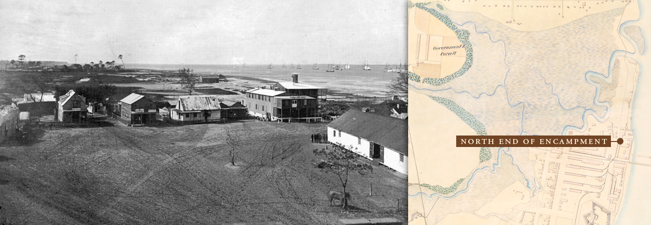
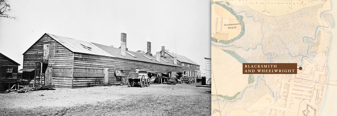
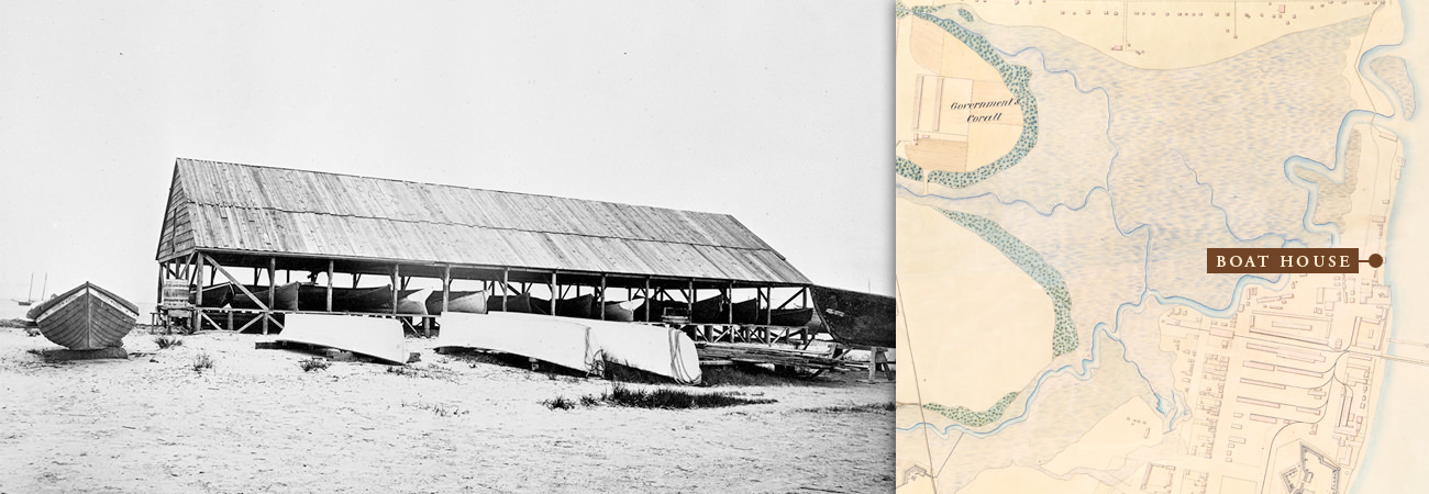
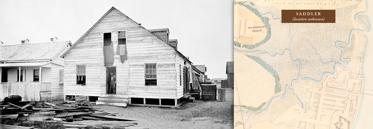
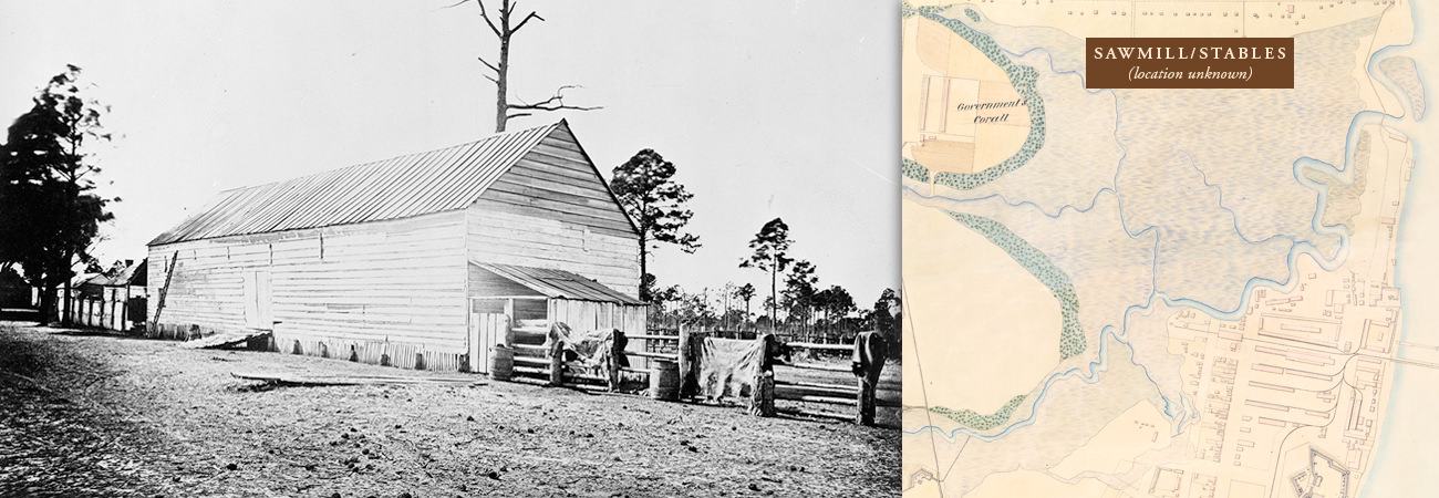
Once the Union Army determined the Confederates had abandoned Hilton Head Island, they set about building a base of operation. Fort Walker, at the north end of the Island on the Coggins Point Plantation, was the center of activity. The army took over the plantation house and used it as its headquarters. The occupying forces built extensive earthworks including Fort Sherman and Fort Welles. Troop camps were established across the island. The Third New Hampshire Volunteers camped at Fish Haul Plantation adjacent to the encampment where they were directed to build a sawmill. Lumber from the mill was used to construct buildings in the encampment including storehouses, commissaries, stables, carpenter shops, docks, and barracks for the African American refugees arriving daily at the Union lines.
An 1865 map shows the encampment's many buildings, Fort Welles, Fort Sherman, and the lines of earthworks. Samuel A. Cooley, official photographer for the Department of the South, also gives us a glimpse of the encampment through dozens of photographs. These photographs are available through the National Archives and Records Administration. Researchers were able to correlate some of the photographs with the map. Click on the map above to see Cooley's photographs.